Monarch River Lodge Salida & the Upper Arkansas Valley
Maysville area Loading weather… --° Connecting 10-day forecast Live data: Open-Meteo

Before you go

Open the latest official reports.

Salida · Maysville · Monarch

Build a mountain day.
Make it yours.

Choose your season and pace for a day in the mountains, with a flexible plan if the weather changes.

Season Golden light · cool evenings
Pace One active anchor
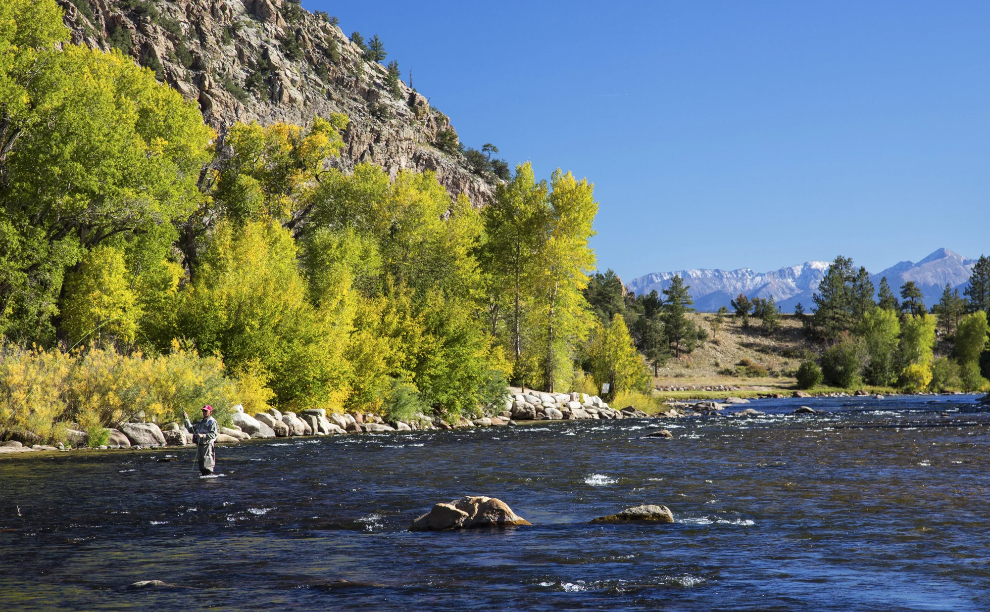
Arkansas River below forested granite slopes and distant mountains in Browns Canyon, Colorado
Arkansas River · Browns CanyonBob Wick / BLM · CC BY 2.0 · cropped

Your field plan

Fall · Balanced day

    Before the first cast or trailhead

    Licenses & permits.

    Official Colorado resources for fishing, hunting, and trail access. Start with the activity, then choose the license or permit that fits your trip.

    01 / Fishing

    A day on the river.
    Or a whole season.

    A fishing license is generally required at age 16 and older. Colorado offers these options through the same official checkout:

    Colorado fishing license options
    DurationAvailable to
    One dayResidents & nonresidents
    Additional dayResidents & nonresidents
    Five daysNonresidents
    AnnualResidents & nonresidents

    Annual licenses follow the license year: March 1 through March 31 of the following year. Select your dates and residency in the CPW shop.

    Buy a fishing license ↗

    02 / Hunting

    Plan the hunt.
    Choose the right license.

    Licenses depend on the species, season, hunting unit, and residency. Some are sold directly; others require a draw application.

    1. Check the species page for seasons, license types, and deadlines.
    2. Review hunter education and any qualifying-license requirements.
    3. Buy or apply through Colorado Parks and Wildlife.
    Buy or apply for hunting licenses ↗

    03 / Hiking & climbing

    Check the place
    you’re heading.

    Permit requirements depend on the trailhead, managing agency, and activity. Check your exact route before heading out.

    Collegiate Peaks: the White River National Forest portion requires a free, self-issued trailhead permit. For Salida and Buena Vista approaches, consult the Pike–San Isabel rules and your trail’s official page.

    Parking, overnight camping, and managed climbing areas can have separate requirements. CPW requires a permit for placing or removing fixed climbing protection in state parks.

    Check local wilderness rules ↗
    Visiting a State Wildlife Area?

    Visitors age 16+ generally need a valid hunting license, fishing license, or State Wildlife Area pass, even for a walk. A state park pass is different. Check the property’s permitted uses and current restrictions.

    Find an area & check access requirements ↗

    Reviewed September 7, 2026 using Colorado Parks and Wildlife and U.S. Forest Service sources linked above. Current fees, eligibility, dates, stamps, and site-specific rules are maintained by those agencies.

    Find your kind of trail

    From river walks
    to alpine lakes.

    Six starting points around Buena Vista, Chalk Creek, and Monarch. Choose by effort, then open the route source for maps and access details.

    01Easy

    Buena Vista · river & foothills

    Barbara Whipple loop

    A short climb from the Arkansas River into the foothills, with views back toward the Collegiate Peaks.

    Distance
    2.1 mi loop
    Elevation gain
    388 ft

    Season: Year-round, conditions permitting

    Parking & route details

    Start at Buena Vista River Park. Multiple connecting trails make a downloaded route map useful.

    Open trail & access information ↗
    Route source & details
    02Easy

    Chalk Creek Canyon

    Cascade Creek loop

    A short interpretive loop with a distant view of Agnes Vaille Falls. The current route does not go to the falls.

    Distance
    0.9 mi loop
    Elevation gain
    Not published by USFS

    Season: Plan for snow-free trail conditions

    Parking & route details

    Trailhead across from Chalk Lake Campground. Follow the current signed loop and Forest Service closure notices.

    Open trail & access information ↗
    Route source & details
    03Moderate

    Nathrop · pine & aspen forest

    Browns Creek Wagon loop

    A forest loop connecting the Browns Creek, Colorado, and Wagon trails. A good middle-distance outing among pines and aspens.

    Distance
    3.9 mi loop
    Elevation gain
    740 ft

    Season: June–October, snow permitting

    Parking & route details

    Use Browns Creek Trailhead off County Road 272. This loop is a different route from the waterfall out-and-back.

    Open trail & access information ↗
    Route source & details
    04Easy–moderate

    Cottonwood Pass corridor

    Lost Lake

    A forest-to-lake outing on the updated Lost Lake Trail #1532. Use the current route rather than older, shorter mileage estimates.

    Distance
    3.5 mi round trip
    Elevation gain
    Not published by USFS

    Season: Plan for snow-free trail & road access

    Parking & route details

    Trailhead along County Road 306 west of Buena Vista. Check road access; no water is available at the trailhead.

    Open trail & access information ↗
    Route source & details
    05Moderate

    Monarch Pass · high country

    Waterdog Lakes

    A climb toward alpine lakes below the Continental Divide. Mileage varies with the lake and turnaround you choose.

    Distance
    About 4 mi round trip
    Elevation gain
    1,047 ft

    Season: Summer–early fall, snow permitting

    Parking & route details

    Parking is along US 50 near the signed trailhead. Review the access description carefully: reaching the trail involves crossing the highway.

    Open trail & access information ↗
    Route source & details
    06Strenuous

    Cottonwood Pass · alpine lake

    Ptarmigan Lake

    A longer climb through forest and open alpine meadows to a lake above 12,000 feet. Start early and watch developing weather.

    Distance
    6.4 mi round trip
    Elevation gain
    1,476 ft

    Season: June–September, snow permitting

    Parking & route details

    Signed trailhead off County Road 306 west of Buena Vista, with a short access road and pit toilets.

    Open trail & access information ↗
    Route source & details

    Route estimates reviewed September 7, 2026. Distances and gain depend on the route; seasons are planning windows, not confirmation that a trail is open. Check current forest alerts and save a trail map before leaving service.

    Get your bearings

    Explore the valley.

    Trailheads, hot springs, camping, and town stops. Select a place for its website and directions. Pins locate public destinations and do not show the lodge property.

    The map loads as you reach this section. Destination websites and directions are listed alongside it.

    Use + / − to zoom. On phones, drag the map to explore.

      Pins are orientation points, not trail navigation or confirmation of access. Check the destination’s current parking, road, reservation, and entry information. Map data © OpenStreetMap contributors.

      A window into the valley

      Look outside.
      See what’s happening.

      Open the live camera pages for a visual check, or the regional calendar to find something worth adding to your day.

      01 / Around the valley

      Salida & Buena Vista webcams

      Town and mountain views collected by the official regional tourism site, including the Monarch Pass area.

      Open regional webcams
      03 / Make a little room

      What’s on in the valley

      Browse upcoming music, festivals, markets, and community events in Salida and Buena Vista. Confirm details with the organizer.

      Open the events calendar

      The land today

      The Lodge Property — A Blank Canvas

      A wooded mountain retreat near Salida and Monarch Pass, shaped by moving water, mature aspens and evergreens, and long alpine views. The lodge itself is still a future chapter.

      Creekside Aspen + evergreen Future lodge
      Walk the landA quiet look through the property 2:35

      A place in the making. No address or precise location is published here.

      Your complete valley notebook

      The best of the Collegiate Peaks, distilled.

      The full 41-page guide covers Salida, Buena Vista, Nathrop, Poncha Springs, Monarch and the Arkansas River—with comparisons, itineraries, planning ranges and direct links.

      41pages 17chapters 222active links

      Research checked July 30, 2026. Reconfirm prices, schedules, access and conditions before booking.

      Best-of board

      Start with the decision that matters.

      Leave-ready checklist

      Pack for the valley. Dress for the pass.

      0 of 8 packed

      Choose your terrain

      Four zones. Very different days.

      Stay low when the sky is uncertain. Go high only when conditions earn it.

      01

      Low elevation · 1–2 hours

      Riverfront

      Walk the Arkansas River corridor, pause at Riverside Park, and keep downtown within easy reach.

      02

      Flexible · 2–3 hours

      Historic downtown

      Mix galleries, shops, food and the riverwalk inside Colorado’s first Certified Creative District.

      03

      Active · half day

      Arkansas Hills

      Choose close-to-town dirt for a higher-output morning, then recover by the river or over lunch.

      04

      High country · half/full day

      Monarch corridor

      Trade valley warmth for alpine weather, broad views and—when operating—a full ski-area day.

      Good mountain manners

      Wildlife gets space. Weather gets a vote.

      Never approach or feed wildlife. Keep food and trash secured, keep dogs controlled, and know your response before carrying bear deterrent. If thunder, smoke, snow or road status changes the equation, turn the day toward town.
      Colorado Parks & Wildlife guidance